
Lastest news
- Observation campaign in the INTA 1000 metrological infrastructure.
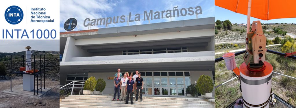 As part of the research project GNSS-Metrology coordinated by the Department of Cartographic Engineering, Geodesy and Photogrammetry of the UPV and financed by the State Plan for Scientific, Technical and Innovation Research, the first observation campaign was carried out in the INTA1000 metrological infrastructure, located in the INTA Campus of La… Read more: Observation campaign in the INTA 1000 metrological infrastructure.
 - Call for a temporary lecturer position in the Department
 The call for the constitution of a temporary employment pool of substitute teachers for the Department has just been published: https://www.upv.es/entidades/SRH/pdi/U0988778.pdf
 - Doctoral Thesis Defense Ceremony
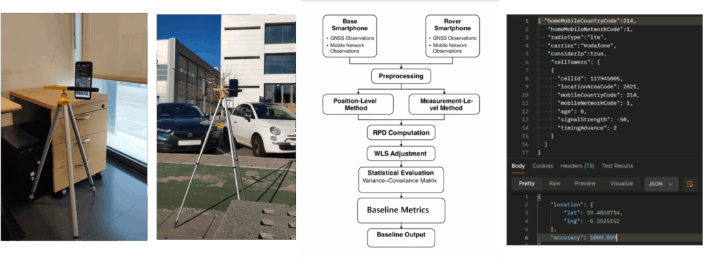 The student of the Interuniversity Doctorate Program in Geomatics Engineering Mónica Andrea Zabala Haro will do his doctoral thesis reading: Mitigation of residual errors in GNSS precise positioning of smartphones on April 20, 2026 at 13:00 in on-line format. This doctoral thesis, directed by our colleagues Ana Belén Anquela Julián… Read more: Doctoral Thesis Defense Ceremony
 - Doctoral Thesis Defense Ceremony
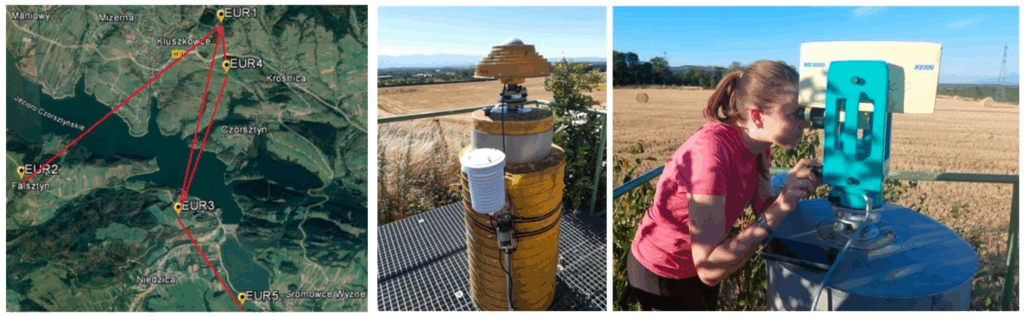 The student of the Interuniversity Doctorate Program in Geomatics Engineering Raquel Luján Garcia Muñóz will do his doctoral thesis reading: Atmospheric refraction in geodetic techniques: analysis of tropospheric effects in GNSS and development of a 3D refractivity model for terrestrial measurements on February 6, 2026 at 11:00 a.m. in the… Read more: Doctoral Thesis Defense Ceremony
Information of interest

Memory
At the beginning of each year, the department management makes available to you the Annual Report with the scientific production and activities.

Regulation
Regulations of the Department of Cartographic Engineering, Geodesy and Photogrammetry (DICGF) published in November 2012 in the UPV Bulletin (BOUPV).

Virtual machines
PoliLabs virtual machines, with the DIGCF desktop and open source/commercial software used in the teaching laboratories.
Latest videos
Department faculty and professionals comment on the applications of the subjects taught by the DIGCF in the Geomatics Engineering degree program.
Student experiences in the UPV/UPM inter-university doctoral program in Geomatics Engineering.
Blogs
Single-person or group corporate blogs of departmental faculty members
Plans and Property
Issues related to the graphic representation of the territory and the delimitation of property, whether public or private.
Administrator: Carmen Femenia
Natalia Garrido
Related topics on GNSS and property delineation.
Administrator: Natalia Garrido
CartoSiG
Topics related to spatial databases, GIS and spatial data infrastructures.
Administrator: José C. Martínez
CCASAT
Cartographic Coordination in the Territorial Administration System (CCASAT).
Administrator: Carmen Femenia
CGAT
Geoenvironmental Cartography and Remote Sensing Research Group (CGAT)
Administrator: Josep Pardo
GiFLE
Photogrammetry and Laser Scanning Research Group (GiFLE)
Administrator: José Luis Lerma
