MaiL MOOC | Qgis example (Part 1)
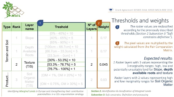
Compilation of the steps to preprocess the marginality indicator layers. Practical exercise of pre-processing of 4 soft indicators in the free software QGIS. The indicators selected for the exercise are slope, soil depth, organic matter content (subsoil and topsoil) and soil texture (subsoil and topsoil). The objective of the exercise is for the student to learn a) the basic QGIS tools to preprocess the layers b)how to prepare the soft indicator layers to obtain a raster for each indicator with 3 values corresponding to 3 marginality ranges: high, low and potentially unsuitable land. Facilitator: Jesús Torralba Pérez
15:29 · 2022


